
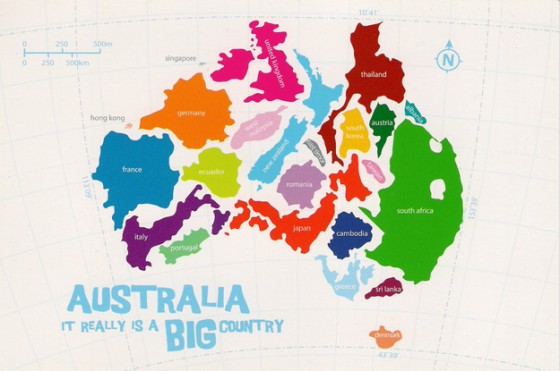
Imagining the size of things is a mathematical skill. It’s called spatial visualisation. Maps are one way humans have invented to imagine what the earth looks like broken up into smaller chunks we call countries. Mercator was a Flemish geographer who imagined the earth as a cylinder in 1569. Most maps we see today are based on this cylinder, opened out to create a rectangle. We can imagine the shape of Australia on this cylinder/rectangle, but what does this shape look like in comparison with other countries.
Your students will enjoy seeing these amazing maps of Australia imposed one on top of another. They will help them visualise the huge shape of Australia better than seeing it alone.
http://www.buzzfeed.com/simoncrerar/mind-boggling-australian-maps#.ntO0lMxbO2